Tuesday, 23 July 2019

Journey Day 12 - Sunwapta Falls to Jasper


Another day of in and out of the vehicle and a mass of cluttered memories so I will work the same as yesterday's blog and base around stopping points. Today was fairly short in miles but intentionally slow in the hope of seeing wildlife.

To our delight, we woke to another sunny day; our luck is holding. Breakfast was orange juice, coffee, cereal and muffin in our lodge then we were out on the road at 9.

Highway 95 North

A short run North on highway 95
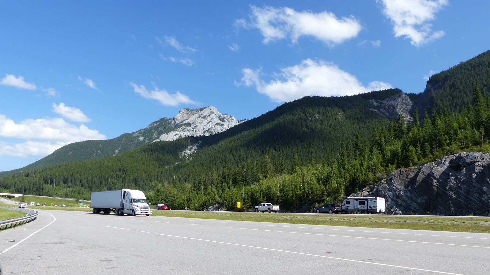
Mountain view from roadside; highway 95

Black Bear Sighting

The vehicle in front of use suddenly braked and pulled over; as we steered past we saw what they were looking at, a black bear just in the woods. Before I could get the camera, traffic including a motorbike passed close to the bear and it disappeared into the trees. We did see its bear behind though, honest!

Goats and Glaciers

A small pull in puzzlingly called Goats and Glaciers had neither, however, it did have wide views of the flat valley bottom with the river spreading across it.

Highway 93A

We turned off the main highway 95 route to Jasper into highway 93A, a much smaller road reputed to be good for wildlife sightings. A single carriageway road, largely 60 kph max. running through pine woods.

Lakeside Pull-in

Unfortunately I failed to note down the name of this lake just off the road but it was worth photographing.
Unknown Lake, 93A

Bear Sighting 2

Several vehicles pulled up following one spotting a Black Bear in the woods opposite. This was a better sighting as we did actually see the whole bear including as it slumped off into the wood.We were too busy looking at it to take good photo's but here is evidence.
Black Bear; head toward camera

Black Bear; heading off into trees

Jasper

We arrived in Jasper around 10:30 and spent an hour exploring shops for such diverse items as a fridge magnet of the Trans Canadian Highway, a bottle of 7UP and a can of OFF! mosquito repellent.
Jasper is a pleasant town so don't be put off that I only photographed the mountains over the busy railway yard.

Maligne Lake Road

With lunch purchased, we headed out of town again down another valley to the South East leading to Maligne Lake. This again was marked as a wildlife hotspot.

Maligne Canyon

The canyon is a water course running through soft limestone which has dug itself a deep channel, gorge, canyon...whatever you like to call it.  Difficult to photograph but very impressive especially the phenomenal power of the water forced through narrow gaps. 
Various walks on offer and we took the 4 Bridges route which took us along the canyon downhill crossing the chasm at several points before climbing back to the the car park.


Medicine Lake

We stopped in a lay by backed onto Medicine Lake to eat our picnic lunch in our now favorite position of sitting on the tailgate. The lake was stunning with its mountain backdrop though if we looked over our shoulder the hillside was scarred by a wildfire in recent years.
Medicine Lake ; lunch view 

Medicine Lake; burnt out trees

Bighorn Sheep

Traffic was brought toa halt at this point by a family of Bighorn Sheep
Bighorn Sheep ; Medicine Lake

Lake Maligne

Lake Maligne itself is at the end of the valley and,being outside the national parks, is more commercial with tour boats and canoe hire being particularly popular. 
We thought we had done well with parking as we took a chance and went passed the main lot and found a space in a small one near the lake side. We gathered our things together and set off to Moose Lake loop only to be met by a trail Closed sign. 
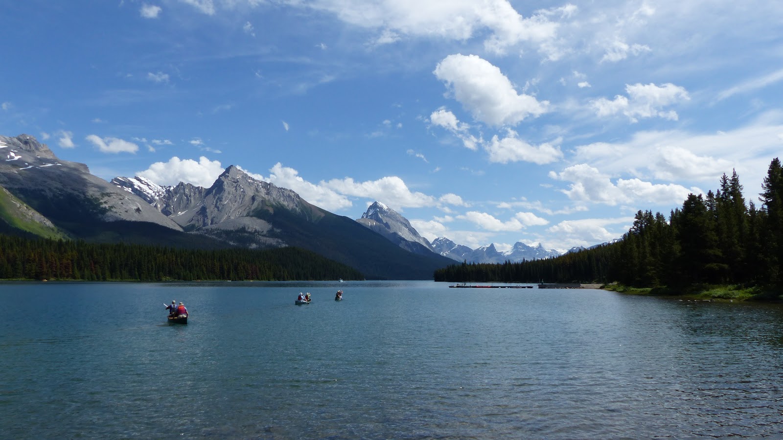
View from near Moose Lake trail head; Lake Maligne
 A bit miffed, we returned to the car and moved back up to the main car park where luckily we got a space as someone left.
Second attempt we set off on the Mary Sheaffer loop trail.
Lake Maligne tourist boatquay

Viewpoint on Mary Shaeffer trail; Lake Maligne


Return to Jasper

As we returned to the car park at Maligne Lake, the skies had darkened and rain was in the air. We decided to return to Jasper having previously considered hanging around till dusk in the hopeof seeing animals.

On the way back, we crawled along at 50 kph but saw nothing other that the same group of Bighorn Sheep again.
When we walked the Canyon earlier in the day, we limited our route to bridges 1-4 so we took the opportunity to visit 5 and 6 via side roads.  By now,the canyon was open and by bridge 6 was just a very powerful river heading to join the main river 100m downstream We were glad we hadn't pushed on and walked it earlier.

Maligne Canyon river at Bridge 6

Evening in Jasper shopping for next 24 hours when we are in a remote area of the Park and eating.
Goodnight.

Today's Statistics

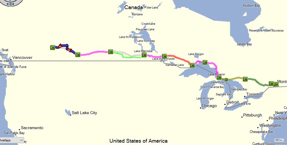
Statistics: Miles today: 101; Miles so far: 2829 ; Fuel added so far: 267.5 litres, 58.8 imp gals; Provinces: Alberta; Time Zone: UTC-6 Mountain Daylight Time (MDT)


Journey Day 11 - Canmore to Sunwapta Falls

Days Inn yesterday had a completely inadequate breakfast room and we expected the same today as we are staying in the same brand; fortunately, they have read the area and a good sized room with group tables was perfectly suitable. Notices that food and drink must not be taken out of the room -they know their clientele, we'd all be building picnics!


Watching the weather as we have journeyed we have been dismayed at mist and rain and winds over the Rockies but this morning as we rise at Canmore in the foothills, the sun is shining and sky is blue; how lucky are we?

Banff and TCH

We set off just before 9 with plenty of fuel on board but as we passed reminder signs, doubts were sewn and we pulled off at Banff to add some petrol. We were pleased we had pulled into Banff; we drove around a few streets and it is a very picturesque town. It looked a great place to be based and return to.

Returning to the route, we are again on dual carriageway Highway 1, Trans Canadian Highway. This takes us quickly to Lake Louise where signs are already up that Lake parking is full; there is a shuttle from a large car park to the South but we passed and carried onto the junction where H/W 1 heads West and we split onto Highway 95 North toward Jasper.

What Not to Do

The problem of a holiday like this is that it is more about deciding what you will not do; Lynne likened it to being in a Supermarket that is about to close with a big shopping list. You know you can only get some of it and have to decide what to drop.

At the end of the day it felt like a few days since we left Canmore only this morning. We drove and stopped all over the place, sometimes a quick look, others a short hike. There is no way I could recall the day in detail so I will list places we took photo's and maybe add a few words.

Herbert Lake

Our first stop of the day and both of us still hold it high in the day's sights with its wonderful reflection.
Herbert Lake

Bow Lake

More well know and heavily parked up. We parked at the roadside not far off the highway and walked down the road and past the lodge. A pretty spot with great mountain views over the lake. We walked a coast path for a while until we'd had enough and returned.
Bow Lake

Pito Lake

Again,we had parked not far off the highway and walked past a lot of cars before reaching the car park. Quite a steep climb to the crowded viewpoint.after taking in the view we followed a rather pointless circular walk before returning down the the car park. 
Famous for its colour, and opaque vivid blue green resulting from the 'rock flour' which washes from the glaciers and reflects the sun.Very pretty but I personally found the opaque appearance a little unnatural. 
Pito Lake

Waterfowl Lake

We were looking for somewhere to eat our picnic lunch and after a few abortive stops pulled into a pull off next to a Lake. We reversed toward it and enjoyed a casual lunch sitting on the tailgate.
Waterfowl Lake; Lunch stop


Saskatchewan River Crossing

Seeing a sign for a Belvadere we pulled up and enjoyed a 10 min circular walk overlooking more amazing views.

Parker Ridge

A high spot as the road rose with switchbacks to reach a pass.
View South from Parker Ridge

Athabasca Glacier

This glacier is above the Icefields Centre and feeds from the Columbia Icefield which covers a range of mountains above. Tours run in tracked vehicles up onto the Glacier itself but this wasn't on our schedule. Instead we were taking the short hike up to the foot of the Glacier.
We spent sometime trying to park at the centre just to see what information they had but gave up and drove down to the foot of the glacier car park were we parked easily.

We hiked up the moraine deposits, quite steep in places passing markers of where the glacier had ended in past years.It is frightening how quickly it is receding especially since the early 1980s.

As we approached we were glad we'd taken spare shirts along as the catabatic winds coming off the cold surface were quite cool. Enjoyable walk with good views of the Glacier, the edges of the icefield and surrounding mountains.
Climbing to foot of glacier

Athabasca Glacier

edge of snowfield

striations on bedrock  

Tangle Falls

We almost drove past Tangle Falls but stopped and were rewarded by a really god falls by the roadside across from a small car park.
Tangle Falls

Sunwapta Falls

We were ready to arrive at our lodgings for the evening; it was only 5 pm but felt like a very long but good day. But, having settled in,we decided to go and view the local Sunwapta Falls while the sun was up. 10 minutes walk down a road and we were treated to and excellent noisy falls running into a tight gorge with extraordinary power.In the English Lake District, this would be called a 'Force'.

Sunwapta Falls

Evening

We had no idea what time we would arrive and so bought in to self cater, including a nice bottle of wine. Tried sitting out but the midges are out in force. It's a bit warm and no air-con so we'll see how we sleep.
across road from hotel

view along road outside hotel

Today's Statistics

Statistics: Miles today: 178; Miles so far: 2728 ; Fuel added so far: 267.5 litres, 58.8 imp gals; Provinces: Alberta; Time Zone: UTC-6 Mountain Daylight Time (MDT)


Sunday, 21 July 2019

Journey Day 10 - Medicine Hat to Canmore

I woke up quite negative this morning, I think the dual carriageway Highway 1 is frustrating me and the miles are not rewarding with interest.However, the sun was shining and open road beckoned.

Avoiding Highway 1

We chatted about the route and I volunteered to drive an extra hour to be able to go off route to hopefully more rewarding roads following Highway 1 for about 110 miles then striking off North to what sounded an interesting are before travelling West again to rejoin the Trans Canadian Highway at Calgary.
We headed West from Medicine Hat across extraordinarily flat lands for miles. Largely rough prairie grasses which did seem to be harvested but not cultivated. Oil pumps were scattered about and pipe heads for natural gas. Sometimes there would be cattle spread about over large pastures; we saw one lonely enormous bull plodding across,it was massive with it's bulk rippling as it walked.
On the horizon a freight train made its way from once side of the panorama to the other looking like a toy. It must have been approaching 1/4 mile long.


I complained bitterly yesterday about the lack of rest stops on the TCH and someone apparently heard me as today there were several pull off lay byes and even a French autoroute style picnic area and toilets in a spotless building with a 3D model of the province.

On reaching the junction with Highway 56 after about 1.5 hours driving we turned North on good single carriageway road. This road was really pretty and an enjoyable drive; it was gently hilly and ran through lush green farmed pasture with occasional small lakes. The green was broken by the golden yellow of fields full of rapeseed; when these fields first appeared in the UK, I hated them thinking they spoiled the appearance of the countryside but years later I have embraced them and even think the add to the pleasing patchwork of our country.

Hoodoos and Dinosaurs

Around 45 miles North we suddenly descended into Red Deer River canyon.The canyon is a valley driven through as the glaciers collapsed and the sides show a mass of layers of different materials. The soil swells and becomes slimy when wet resulting in conical piles left as the water washes off and through. We turned East for about 10 km to where Hoodoos had formed. A Hoodoo forms when a hard stone has come to the top and provides a sort of umbrella changing the erosion pattern. The soil below the capstone is protected while the rest is washed away leaving pillars topped by stones; these are hoodoos and are seen in many places, the most extraordinary we have seen being Bryce Canyon in the US. We parked and spent around 20 mins exploring and viewing the hoodoos. It was very busy being a Sunday lots of locals were around with their children clambering all over the slopes. I couldn't quite decide whether the delicate soils should be more protected but lots of families were having fun. The current hoodoos were fenced and viewing platforms provided but creation of more it unlikely with such foot traffic.


Back West to rejoin the route we have no time to take in the Royal Tyrrell Museum at Drumheller where fossils from the area are collected and displayed. It even possible to take a bus out to where digs continue. Some of the largest dinosaur remains found lay in these soils and discoveries continue. A visit takes about 3 hours and we had 30 mins. We took in the Visitor Centre and asked about other things to see quickly and settled for Horseshoe Canyon which was on our route about 25 km further on.

We stopped by Horseshoe Canyon at a viewing point. The same terrain in which the hoodoos formed but in a deep valley,not overrun this time though there are pathways through it.

Horseshoe Canyon

Passing Calgary

The sunny afternoon continued as we headed toward Calgary. Joining Highway 2 South we encountered our first 3 lane dual carriageway; just like a motorway back home and almost as busy. In the distance we eventually saw the tower blocks of Calgary centre before we joined the peripheral Highway and pasted around to the West once again joining Highway 1,Trans Canadian Highway.
The traffic going towards the city was intense; being a Sunday around 4 PM we could only guess it was traffic returning from weekend trips to the Rocky Mountains area. Calgary is a massive city and from the ring road we say vast housing estates stretching miles from the city.

We could now see vague outlines of mountains in the far distance,about 60 miles away. Over the next hour they gradually became clearer. The terrain around us felt reminiscent of low alpine regions of France and Switzerland and we had the company of trees again after last seeing them in Western Ontario.


Arrival

With relief, we checked into our hotel in Canmore. We are now in the area that bookings were difficult and accommodations are full. Across the road,high jagged peaks look down on the town alight from a beautiful evening sun. Suddenly, the drive feels worthwhile again.

Over the road to Safeway to buy in supplies for tomorrow evening and next door to the liquor shop for wine and beer. It seems really alien that you ca't by alcohol in a big supermarket.

World's Biggest

Two of them today.

World's Biggest Teepee; Medicine Hat

World's Biggest Dinosaur - Drumheller 

Tomorrow we explore the Rockies so it's good night for now.

Today's Statistics

Statistics: Miles today: 308; Miles so far: 2550 ; Fuel added so far: 250.9 litres, 552 imp gals; Provinces: Alberta; Time Zone: UTC-6 Mountain Daylight Time (MDT)


Day 10 close in

Saturday, 20 July 2019

Journey Day 9 - Regina to Medicine Hat

A little slow getting going today, another hour change yesterday on top of tired anyway.

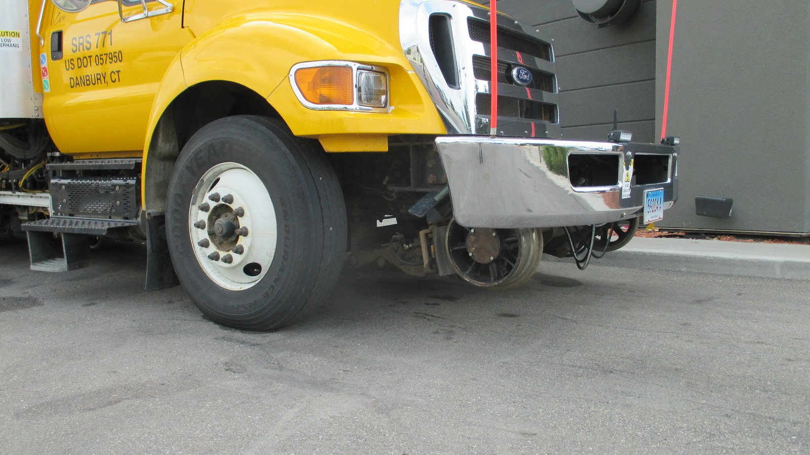
Yesterday we noticed trucks working near a railway had a second set of wheels to lower on to the tracks and one was parked near us in the hotel car park this morning.

Retractable Rail Wheels 

Highway Driving

Today was a Highway 1 day; over 300 miles mostly on cruise control at 110 km. A lot of today was more of the same, open wide views and little going on. Though the scenery is the same, it is different charging along at 70 mph on what is effectively a motorway though with A road rules. Though perfectly legal, it isn't safe to pull up on the shoulder and at that speed, by the time you spot a photo you want to take you are way past.

Highway 1 Trans Canadian Highway, Saskatchewan

Basically, not a lot happened that I recall to write; but here goes anyhow.

We did pass 2000 miles today so should be over halfway in mileage.

Prairies

We are now in the Prairie, described in the travel books as a wild remote region. Actually, it may have been open prairie but now it is mostly vast flat farmed fields full of crops which there is little romantic about it; though it is pretty when the sun is out. The 'remoteness' is bit of a fiction in this season; with modern cars, unless you set off with only a quarter tank, there is no issue with getting fuel. I guess winter conditions would be a very different matter.
Morning temperature today started at 17C and stayed below 21 till after lunch.

We had no suitable alternative routes today but broke from Highway 1 at Moose Jaw to have a look around the town which was accredited with buildings which could be used for 1920's Chicago in movies. Actually, there were about three buildings which matched this description but we enjoyed passing the rail freight yards and generally a look around town. We pulled into Safeway (still exists here) and stocked up with sandwiches and a few bits for the journey before returning by the same route to the Highway.

Canadian Pacific Railway freight

Sand Hills
The flat fields began to give way to more varied terrain. Where ground was exposed the under soil was sand and the prairie began to emerge with less crops. The landscape undulated with sand hills; not exposed sand as in dunes but rounded bulges of grass. In the earlier miles the grass seems a good quality and we see more grazing animals, especially around water holes gathered in the dips.

Sand Hills

At one point a huge industrial structure alongside gigantic piles of salts scars the landscape to the North, Potash is a big industry around here. Later, to the South a large shallow lake is surrounded by evaporating salt pans.

Rest Stops

The Trans Canada Highway, since we left the Forested areas in Ontario, does not have rest areas and toilets which is an inconvenience. Several times we saw signs for picnic areas only to find closed sites or no sign of anything. We eventually stopped at a garage and shop but didn't like the scrappy picnic area so crossed over the railway and ventured into the small town behind. We had lunch sat on the tailgate by a park and some houses.

Lunch stop in small community

Back heading toward Alberta the Sand Hills became more sparse with thin grass and stony dips. This area was not supporting any crops or grazing. And so the afternoon passed with sand hills, new areas of pasture and always Highway 1 stretching out ahead.

Prairie Sand Hills

Highway 1 through an unusually hilly section

Alberta Time

Crossing into Alberta we also crossed a timezone going from Central Standard to Mountain Daylight Time; however, as Saskatchewan did not operated daylight saving and Alberta does, there was no change.
Alberta tourist information visited and maps and guides collected and we arrived at Mexican Hat just after 5 pm.

Evening

We walked out to a nearby restaurant as I really didn't want to stare out of the windscreen any more today. It's cold, don't know what temperature but the air-con is off and we have got jeans and jerseys on. On the positive side, we may sleep better tonight without air-con rattling away.

Today's Statistics

Statistics: Miles today: 303; Miles so far: 2242 ; Fuel added so far: 206.6 litres, 45.5 gals; Provinces: Saskatchewan & Alberta; Time Zone: UTC-6 Central Standard Time (CST) to UTC-6 Mountain Daylight Time (MDT)